"You can 'do' Nitmiluk National
Park in a morning" said one of the grey nomads floating about in
the pool with a kiddies pool noodle (though he seemed to have enough
of a noodle around his midsection to keep him afloat) near where we
had our caravan parked as we prepared for the Jatbula Track. "Easy,"
he continued, "drive out in the morning, take the 9 am boat tour
and be back at the caravan park by lunch", and, presumably back
in either the air-conditioned comfort of your caravan with the TV on,
or floating about in the pool with one or more noodles.
"Curses," I thought. We had
just spent a day kayaking up to the top of the third gorge, another
three days hiking to Eighth Gorge and Smitt Rock and here we were
packing for another four day hike. All that time wasted when we
could "do" Nitmiluk in under eight hours, not eight days as
we were planning. Travelling Australians frequently talk of "doing"
various parts of the country although it has never been clear to me
how sitting by your caravan "doing" nothing can actually
amount to "doing" anything.

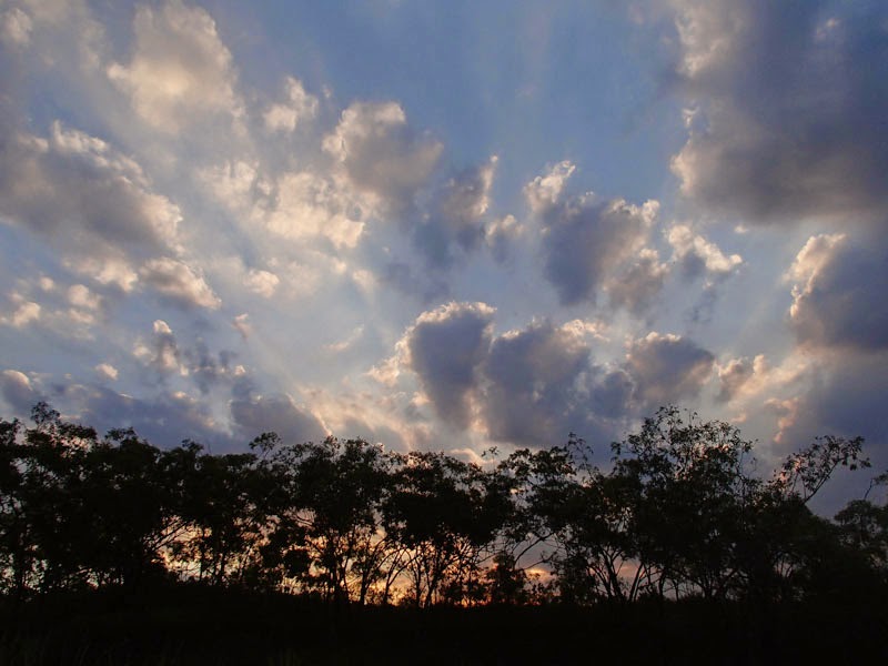
Morning at Nitmiluk Gorge
How can you have "done"
Nitmiluk National Park when you haven't camped on the beach at Smitt
Rock and gone swimming in the river after dark as shooting stars sear
across the sky? Or walked across the dry stone country from
waterhole to waterhole swimming under thundering waterfalls and
camped by billabongs? Is it possible to "do" Nitmiluk
National Park without seeing the aboriginal paintings tucked away in
caves? Or not having scared up feeding lorikeets as you walk past in
dense Mitchell grass?
The Jatbula Track runs for 60 km from
Nitmiluk Gorge to Leliyn Falls describing a wide arc around 17 Mile
Creek and then following the Edith River west. There are campsites
every 10 km or so, each situated by deep waterholes or cascading
waterfalls. While there is no "formed footbed" the track
is actually pretty good for most of the way, although there are
occasional areas of swamp and dense vegetation. Blue arrows mark the
route every 20 to 50 metres. Mostly, the track is easy to follow,
and surely gets easier later in the season as more hikers complete
the track and the tall grass falls over. Early in the season, some
areas require a little searching about to stay on the track. The
biggest difficulty is getting back to Nitmiluk Gorge to pick up your
waiting vehicle as this is a one way walk.
Day 1, Nitmiluk Visitor Centre to
Crystal Cascades
For some reason, Parks and Wildlife
and/or Nitmiluk Tours (who have the commercial aspect of Nitmiluk
Gorge tightly wrapped up) have re-routed the track so that you now
"need" to take a boat (Nitmiluk Tours) across the Katherine
River to the start of the hike. This is a completely artificial
barrier and, for deep philosophical reasons (a self-propelled
activity should be self-propelled in as much as possible) we decided
to circumvent this process. I won't detail here how we did it, but
it is easy and adds only an hour to your walk.

The gorge below Crystal Falls
The first hour of the "real"
walk leads along the base of the northern cliffs of Nitmiluk Gorge to
arrive at the Northern Rockhole. In early June, the falls were dry
apart from a trickle of water, but the water hole at the base is deep
and cooling. We had the first of four days worth of naked swims.
Five minutes after leaving the Northern Rockhole, the track meets a
management track (another potential access track) and continues
through dry savannah country to Biddlecome Cascades. The cascades
fall in a series of small drops separated by deeper waterholes. We
had lunch and another swim here. There is a campsite, but as this
spot is only about 8 km from the start, it seems too early to stop.

Doug in the dry eucaplypt forest
We walked on another few hours to
Crystal Falls, pushing through high dry Mitchell grass, past clumps
of spinifex and alongside the bright orange flowers of woollybutt
trees. About a half hour before Crystal Falls we stopped in a
tributary creek and drank a full litre of water with electrolyte mix
and had a quick snack. It was near 3.00 pm and baking hot under the
tropical sky. At Crystal Falls, the first thing we did was strip off
our sweaty clothes and plunge into the deep lily fringed pool above
the falls.
Day 2, Crystal Falls to 17 Mile Falls
Continuing from Crystal Falls, you
either walk a long way to the next camp (27 km to Sandy Camp) or a
short way to an intermediary camp (10 km to 17 Mile Falls). We opted
for the short option and camped at 17 Mile Falls which absolutely
should not be missed. The track crosses the creek (a tributary of 17
Mile Creek) and an overlook gives a view of Crystal Falls dropping
into a deep narrow gorge carved into the sandstone where eucalpyt
trees cling improbably to the rock walls. Easy walking across the
grasslands where you can catch glimpses of the big broad 17 Mile
Valley lead to the edge of a small escarpment on a tributary of 17
Mile Creek. A short side track descends to caves below where
aboriginal art paintings are surprisingly well preserved as if the
artists themselves had just stepped out to hunt goanna and kangaroo.
Improbably, the interpretive sign describes the side track as
"suitable for all and generally easy" seeming to ignore the
fact that it is a day and a half walk to this junction.

Aboriginal art in The Ampitheatre
Another easy hour of walking leads to
the campsite at 17 Mile Falls tucked under shady paperbarks on a
sandy ground surrounded by slabs of hard, red sandstone. You can
scramble down to the base of 17 Mile Falls on a rudimentary track
(north side of the river) and swim in the large deep pools below.
Under 17 Mile Falls the spray blows back into the air making rainbows
and the rocks are worn smooth by flood waters. As the sun set that
evening, the cliffs lit up red as forest fire and broad streaks of
thin clouds streaked out above the eucalpyts.

17 Mile Falls
Day 3, 17 Mile Falls to Sandy Camp
From 17 Mile Creek, the track heads
west across dry eucalpyt savannah to reach the Edith River. Early
on, the track dips into a couple of narrow drainages where small
amounts of water linger later in the year, but this is mostly dry
country. A squadron of feral pigs trotted along beside me for a
while before picking up my scent (pretty strong by this stage) and
sprinting off. At Edith River Crossing, the river is still small and
easy to ford, further west it swells in volume to fall over sandstone
cliffs at Leliyn Gorge. There is some swampy ground and thicker bush
in the riverine Edith River valley and I was dismayed to find my new
hiking shoes soaked through with muddy water. Sandy Camp is a lovely
site under large paperbark trees beside a big round waterhole on the
Edith River. The water is cool for swimming and at sunset the trees
surrounding the waterhole are reflected with astonishing clarity in
the calm water.

Sunset swim at Sandy Camp
Day 4, Sandy Camp to Leliyn Falls
The last day of the walk follows the
Edith River west to the Leliyn Falls. Immediately after leaving camp
the track is hard to find in dense bush but within an hour the track
emerges into dry open forest and is easy to follow. At a couple of
marshy areas I took my shoes off and waded in ankle deep soggy mud to
avoid wetting my shoes. There is a checkpoint but not much else at
Edith River South and after about another hours walk, Sweetwater Pool
is reached.
This big deep pool on the Edith River
has terraced rock slabs perfect for resting on after swimming in the
clear cool waters. I expected to meet up with some day hikers from
Leliyn Falls as it is only 4 km along a good trail to Sweetwater Pool
- who wouldn't want to visit a place with such an evocative name? -
but we only encountered two older folks out bird-watching. All the
youth (and non-youth) had been unable to walk further than the upper
pool from the parking area (just over 2 km return!). I'm not sure
why I continue to be surprised by the sloth of the general population
(young and old alike) but I am.

Below Leliyn Falls
Around lunch time we intersected the
Leliyn Loop tourist walk and took the long way back to the car park
past the upper pool and Bermang Lookout. Here the river thunders
with surprising force through narrow rock canyons separated by
spilling falls. As always, it was difficult to end a trip into the
wilderness. Life is just somehow better when each day requires
nothing more of you than putting one foot ahead of the other,
admiring the scenery and sleeping out under the stars. We had to
wear swim suits for our final swim in the big deep pool under Leliyn
Falls and listen to the grey nomads floating about with the
ubiquitous pool noodles whining about how cold the water.
The car park at Leliyn Falls was
distressingly empty as we were hoping to hitch-hike back, at least as
far as Katherine. The price we had been quoted for a shuttle back to
Nitmiluk Gorge ranged from $190 to $270 (everyone is making money on
this walk except Northern Territory Parks and Wildlife who charge
$3.30 per person for a campsite) and just didn't seem justifiable for
a four day walk. Luckily, a very kind couple picked up a couple of
smelly hikers with packs and took us all the way into Katherine.
These kind folks actually offered to drive us right out to Nitmiluk
Gorge even though they were not going that way themselves. From
Katherine, we broke down and got a taxi out to the Gorge as it was
getting late and we were wanting our dinner.
In order of price, the cheapest fare we
found for a shuttle was with Star Bush Taxi who quoted us $190 for
the full distance from Leliyn Falls to Nitmiluk Gorge, Gecko (a local
tour company) came in next at $250 (Gecko actually charges $55 per
person but that is based on a minimum of four people), and finally,
the local taxi company wanted a whopping $270 for the 90 km trip.
Unforgettable night skies
G'day, Enjoying the blog.
ReplyDeleteA group of friends and myself are doing the Jatbula in August and like yourself I have a deep philosophical objection being tied to the Ferry crossing just to start the walk. From Google Earth I assume you went downstream and made a crossing somewhere around the camping area. Any chance you could email me the directions? johnspye@hotmail.com
Regards, John
Sent your way, John. Enjoy. It's a beautiful walk.
ReplyDelete